Trending
Nepal Flood Video Shows Sudden Devastation as Glacier Collapse Sends Debris Through Mountain Valleys
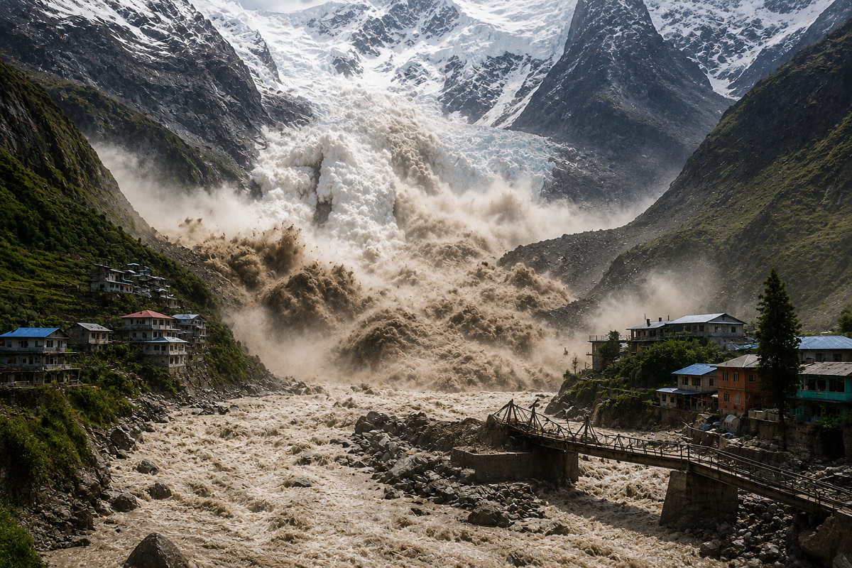
Nepal Flash Flood Video: Dramatic videos from Nepal’s Rasuwa region have captured the terrifying speed of the Himalayan flood that tore through settlements near the Tibet border, sweeping away buildings, vehicles, bridges and other infrastructure within minutes.
The disaster struck on August 26, 2026, after a massive collapse involving glacial ice, rock and sediment high in the mountains. The resulting surge rushed through the Lhende Khola and into the Bhote Koshi-Trishuli river system, devastating communities downstream. Scientists studying satellite images say a substantial part of a glacier broke away at an altitude of roughly 5,200 metres and crashed more than 1,200 metres into the valley below.
The videos circulating online are striking because they show how quickly conditions changed. What initially appears to be a relatively calm mountain landscape is suddenly overtaken by a fast-moving wall of muddy water, boulders and debris.
Viral Videos Show How Quickly the Flood Arrived
Footage from affected areas shows muddy floodwater accelerating through narrow valleys and surrounding buildings almost instantly.
This is seriously scary. CCTV footage from Gyirong Port in Tibet, China, directly opposite Nepal’s Rasuwa district. This flash flood hit here first and later caused massive havoc in Nepal. Can’t even imagine someone surviving this. Prayers for everyone affected. 🙏 https://t.co/o805P8KGSu pic.twitter.com/31QzZ64aBD
— Nikhil saini (@iNikhilsaini) August 26, 2026
The flow was not simply ordinary river water. It carried huge quantities of sediment, stones, ice and other debris, greatly increasing its destructive force.
Videos and eyewitness accounts show structures being hit by the surge, vehicles being carried downstream and bridges collapsing under the pressure of water and debris. Reuters reported that entire settlements and project sites were overwhelmed as the flood moved through Rasuwa and surrounding districts.
The speed of the event is one of its most alarming features. In mountainous areas, a sudden release of ice and rock can generate a powerful downstream surge with very little warning for people living along the river.
Rasuwa Among the Worst-Hit Areas
Rasuwa district, close to the Nepal-Tibet border, has suffered some of the most severe destruction.
The affected region includes important border trade routes, hydropower facilities and settlements built along narrow river valleys. Roads and bridges were damaged or completely washed away, making rescue operations much more difficult.
Reuters reported that the flood surge moved through the Bhote Koshi and Trishuli river systems and caused serious destruction in areas including Rasuwa, Nuwakot and Dhading. Water levels reportedly rose by several metres downstream within a short period.
The scale of infrastructure loss has also disrupted communications and electricity supplies in several locations.
What Caused the Nepal Disaster?
Early reports mentioned several possible triggers, including landslides, heavy rainfall, an earthquake and a possible glacial lake outburst.
However, more recent scientific evidence points toward a glacier collapse and ice-rock avalanche as the principal physical event.
Satellite images reviewed by experts showed that a large section of a glacier broke away before the flood. The collapsing ice appears to have entrained rock and sediment as it descended, creating a massive debris flow that entered the river system.
Nepalese officials also examined whether an earthquake recorded shortly before the flood may have contributed to destabilising the glacier, although investigators have not yet established the precise trigger for the collapse.
The Associated Press reported that the event first thought to be seismic activity was subsequently identified by the U.S. Geological Survey as a glacial collapse.
Was It a Landslide or a Glacial Flood?
The disaster is sometimes being described simply as a landslide or GLOF, but the latest evidence suggests a more complex event.
A large mass of glacier ice and rock appears to have fallen into the valley, generating an avalanche and debris flow that subsequently produced catastrophic flooding downstream.
That distinction matters because different Himalayan disasters can have very different causes. Some are triggered by extreme rainfall, others by glacial lake outburst floods, and some by rock or ice avalanches.
In this case, researchers are still studying the exact sequence of events, so describing it as a confirmed GLOF would be premature.
Hundreds of People Remain Missing
The human impact has been enormous.
By August 27, Nepal had confirmed 157 deaths, while hundreds of people remained missing. China also reported fatalities and hundreds unaccounted for on the Tibetan side of the border.
Many of those missing are foreign visitors, including pilgrims and tourists travelling through the Himalayan region.
Rescue teams from the Nepal Army, police and armed police have been deployed, but damaged roads, thick sediment and high water levels have slowed operations.
Helicopters have also been used where conditions permit, although reaching remote valleys remains difficult.
Why Himalayan Floods Can Become So Destructive
The geography of the Himalayas can transform a sudden upstream event into a devastating downstream disaster.
Steep slopes allow water and debris to accelerate rapidly. Narrow valleys concentrate the flow, while loose rock and sediment can be picked up along the way.
That means a flood may become progressively heavier and more destructive as it moves downhill.
Settlements, roads and hydropower projects are often located beside rivers because usable flat land is scarce in mountain regions. Unfortunately, these same river corridors can become direct pathways for flash floods and debris flows.
Climate Change Is Adding to Himalayan Risks
Scientists have warned that warming temperatures are changing the stability of glaciers throughout the Himalayan region.
Reuters reported that Nepal has lost nearly one-third of its ice over the past three decades and that ice loss has accelerated significantly in recent years. Rising temperatures can increase glacier melt and may contribute to unstable mountain conditions, although scientists usually avoid attributing a single collapse directly to climate change without further study.
The latest disaster nevertheless reinforces concerns about how climate change, fragile geology and expanding infrastructure are combining to increase risks in the Himalayas.
Videos Offer a Warning About the Need for Early Alerts
The viral footage does more than document destruction. It demonstrates how little time communities may have to respond when a high-altitude disaster occurs.
Effective early-warning systems could therefore become increasingly important. Satellite monitoring, glacier surveillance, automatic river gauges and downstream sirens can provide valuable information when dangerous changes are detected.
Cross-border information sharing is equally important because Himalayan rivers often flow across national boundaries.
Nepal, China and India all share river systems originating in high mountain areas, meaning a major upstream event can quickly affect communities far downstream.
The August 26 disaster has become another stark reminder that Himalayan hazards can develop with extraordinary speed. The videos now circulating online capture only a few moments of the catastrophe, but they underline a much larger challenge: improving monitoring, infrastructure planning and emergency preparedness before the next sudden mountain flood strikes.
Note: Investigations into the precise trigger are continuing. Current scientific assessments point primarily to a glacier and ice-rock collapse rather than a confirmed glacial lake outburst flood.